The design is far from perfect, but it's pretty nice to finally see a continuous, two-way bike connection between Aberdeen and the Waterfront.
By Ryan McGreal
Published October 24, 2017
The City is installing two-way cycling infrastructure on Bay Street between Aberdeen Avenue and Stuart Street in a project that has been partially funded by the Ontario Municipal Cycling Infrastructure Program.
Yesterday, Kevin Love clearly laid out the overall pros and cons of the new bike lanes, which are currently under construction. However, as the design comes together block-by-block, it is worth considering in some detail how the lanes will work along each segment.
I took a ride along most of the route during the weekend and went back yesterday for a follow-up, and here are my impressions of how the design will work.
The southbound bike lane ends right at Aberdeen Avenue next to the bumpout planter on the northwest corner of Aberdeen and Bay, delineated between Aberdeen and Cannon with a yellow line to indicate the southbound opposing directional (contra-flow) lane on a street that is otherwise one-way northbound.
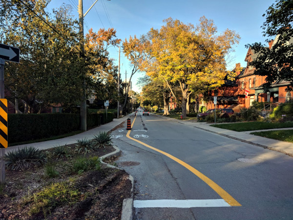
Southern terminus at Aberdeen Avenue
Because of the bumpout, the northbound lane starts approximately ten feet north of the corner, meaning any cyclists joining Bay from Aberdeen will have to ride in mixed traffic for the first bit.
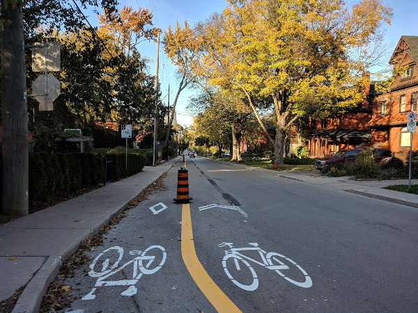
North of Aberdeen
North of the bumpout, the two-way cycle track begins in earnest. Like the two-way cycle tracks on such otherwise-one-way streets as Cannon and Hunter, the two-way cycle track on Bay runs along the leftmost lane if you're facing the prevailing flow of automobile traffic, hence allowing the contraflow bike lane to run to the left.
That means cyclists travelling in the same direction as the automobile lanes will do so on a bike lane immediately to the left of the driving lane.
This provides a measure of awkwardness that is exacerbated by the City's decision not to provide physical protection along the full length of the cycle track. The Bay Street lanes will be unprotected between Aberdeen and Hunter, and only protected between Hunter and Cannon.
The first cross-street heading north from Aberdeen is Markland Street, which is one-way westbound for cars and has an east-bound contra-flow bike lane. Similar to Cannon Street, the City has installed pavement markings - sharrows - along the bike lanes and across the intersection.
It looks like the City has installed these sharrows across every intersecting street along the cycle track portion of the Bay Street bike lanes.
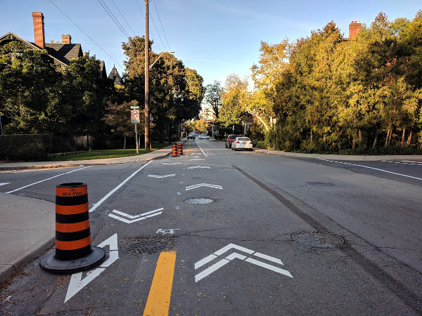
Bay and Markland
I didn't see any specific pavement markings or design elements to facilitate northbound cyclists turning right onto the contra-flow bike lane on Markland, but that might change before the lanes officially open.
The next block north of Markland is Herkimer Street, which has more moving parts. In particular, Herkimer has a fairly busy protected bike lane along the north curb, which is physically protected from vehicle traffic by a line of parallel parking.
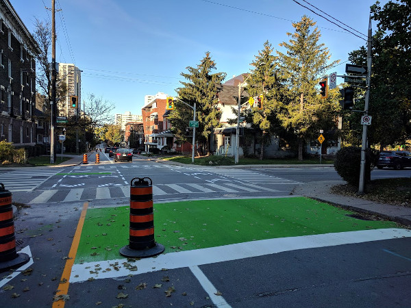
Bay and Herkimer
The City has installed a green-painted advanced stop line, or "bike box", on Bay to allow northbound cyclists turning right to proceed ahead stopped cars. It's nice to see the City is slowly getting over its inexplicable fear of green sidewalk paint.
From there, the City has also painted dashed bike lane markings and chevrons on the right side of Bay to connect with the Herkimer bike lane.
While this falls short of the Netherlands standards for bike-car interactions through an intersection, it is the closest thing I have seen so far to the elegant Dutch solution to this conflict zone, which retrofits a carefully-calibrated counterclockwise bicycle traffic circle into the intersection.
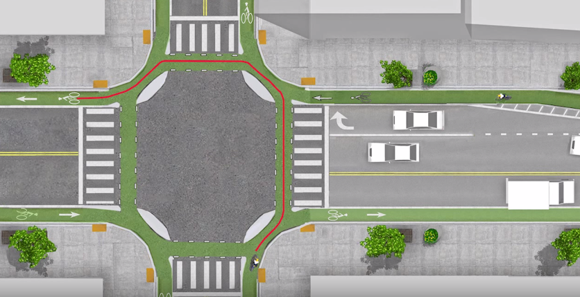
Netherlands intersection design
Meanwhile, Bay and Herkimer is also a fully signalized intersection, which means the City has installed north-facing traffic signals for southbound bike traffic on Bay. The new signals are covered for now, but I assume the signal lights themselves will be bicycle-shaped lights similar to the contraflow traffic signals on Cannon.
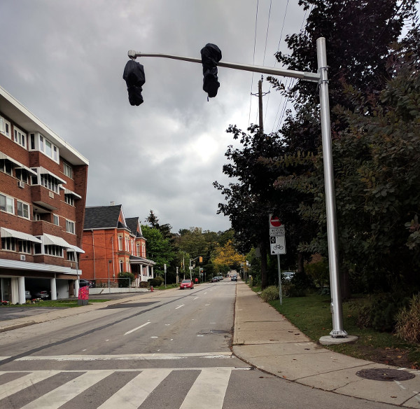
North-facing traffic signals
The next intersection is at Charlton Avenue West, which is one-way westbound and has a one-way westbound bike lane, also protected from the vehicle traffic by a row of parallel-parked cars. Turning left onto Charlton is easier here, because the Bay Street bike lanes are already on the left side.
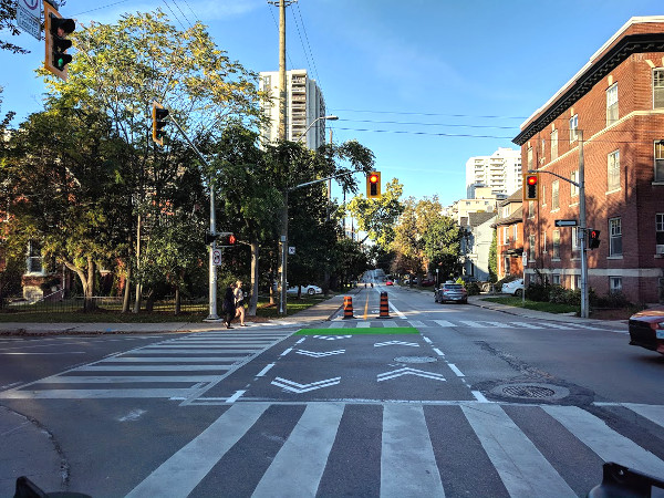
Bay and Charlton
Like Herkimer, Charlton is also fully signalized, so there will be north-facing traffic signals for southbound bikes.
Herkimer and Charlton are designated "local collector" streets that carry significant volumes of traffic and warrant traffic signals. The next block is Robinson, a residential side street running one-way eastbound that has stop signs on Robinson but not Bay.
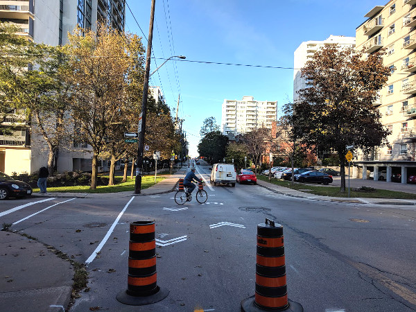
Bay and Robinson
As you can see, the sharrows are still painted across Robinson, raising the visibility of the lane for eastbound traffic.
On the block north of Robinson, we start to get into residential skyscrapers where the cycle track crosses ramps into and out of the parking garage. The City has added diamond lane and bike stencil pavement markings in front of the ramps to increase the visibility of the bike lanes for cars pulling into and out of the buildings.
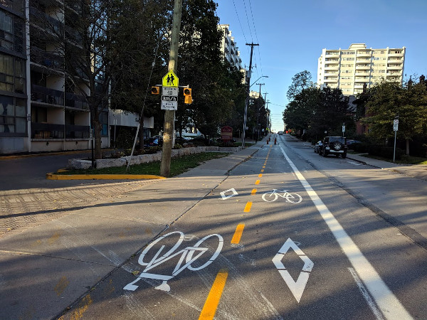
200 Bay Street
Like Robinson, Duke and Bold are local residential streets in which the intersection has stop signs on the side streets but not on Bay. The City has added the sharrows across these streets that we have come to expect.
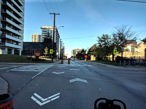
Bay and Bold
Sidenote: unlike Robinson, Duke and Bold are two-way - they were recently converted despite the usual apocalyptic predictions of chaos and they work just fine as local residential two-way streets.
The next intersection is Hunter Street, which is one-way westbound for cars and has a bi-directional cycle track on the south curb lane. When I visited this intersection, the City was still doing some sidewalk work on the southeast corner (the corner with Central School) and had not yet added pavement markings.
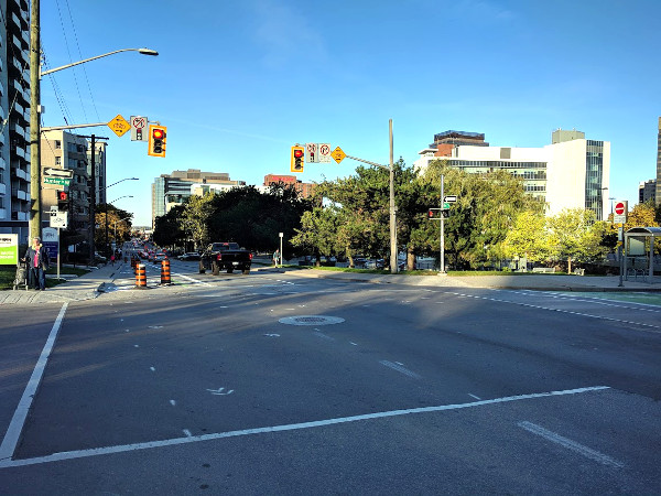
Bay and Hunter
I expect there will be another green-painted bike box here for cyclists turning from Bay eastbound onto Hunter.
Hunter also marks the point at which the Bay Street cycle track becomes physically protected. South of Hunter, for reasons I cannot properly fathom, the City decided to leave the cycle track unprotected. This matches the cycle track on Hunter, which is also unfathomably unprotected.
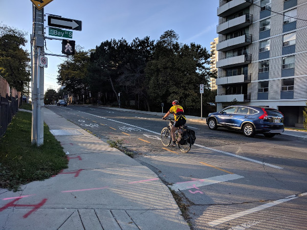
Unprotected cycle track on Hunter
The City's own bike count data clearly indicates that bike traffic grows a lot more significantly when the lanes are physically protected, as on Cannon Street, than when they are not, as on Hunter Street.
I honestly do not understand why this is still even an issue. Even on Hunter, there is a stretch that is protected by knockdown sticks just east of Park Street, and the City is able to clear snow in the winter using a pickup truck with an attached snow plow.
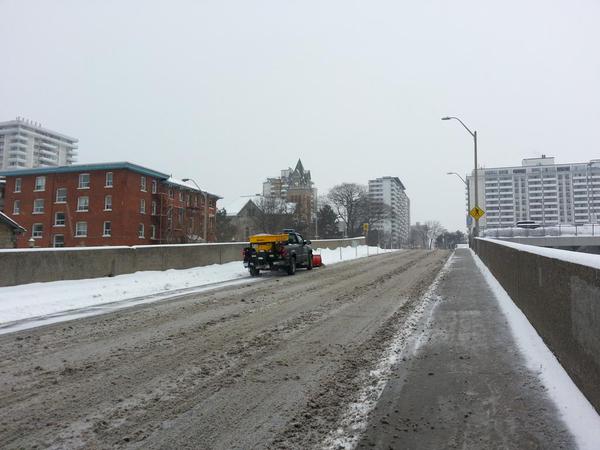
Clearing the Hunter cycle track behind knockdown sticks (RTH file photo)
Unprotected bike lanes not only feel less safe due to the lack of physical barriers to keep cars out, but also invite drivers to use them as convenient parking spots.
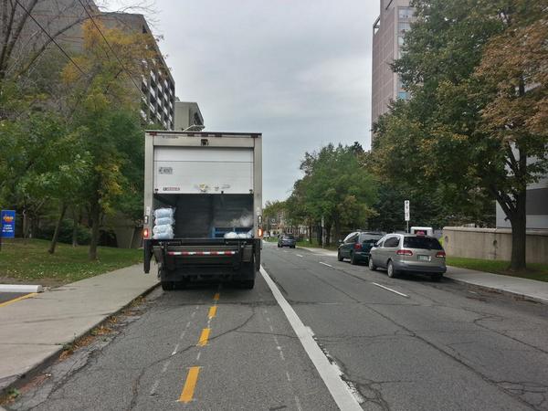
Delivery truck blocking Hunter Street bike lanes (RTH file photo)
This is especially the case for two-way cycle tracks, which are wide enough to park an entire vehicle.
It seems the only place the City is willing to install physical protection is where they can provide an additional buffer zone between the car lane and the bike lane, as we see on Bay north of Hunter.
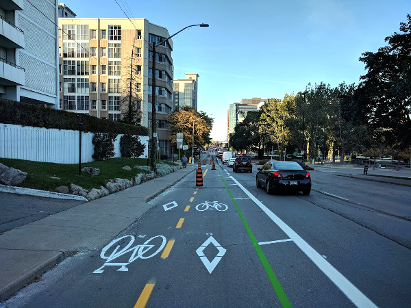
Bay north of Hunter
Perhaps the City doesn't want drivers hitting the barriers - but any driver who veers far enough out of their lane to hit a knockdown bollard is also in real danger of hitting a cyclist.
Ironically, as Jason Leach pointed out last week, the City clearly recognizes that they need to physically protect the bike lanes (with large traffic cones) while the paint is drying to keep cars from driving across the paint, but fails to consistently apply the corollary point about keeping cars from driving over cyclists.
The next major intersection is at Main Street, which is a major arterial and a five-lane, eastbound traffic sewer. Almost no one is going to be turning from Bay onto Main, so the important thing is to make the bike lanes visible to drivers on Main who are turning left onto Bay. (Now that Bay is turning into a two-way street, it will no longer be legal to turn left from Main onto Bay on a red light.)
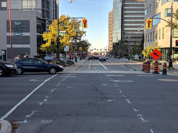
Bay and Main
I was on Bay yesterday between Main and King, when the City was installing physical barriers to protect the lane. I was happy to see that they are installing both knockdown bollards - with green bicycle flags on top - and heavy-duty rubber curbing.
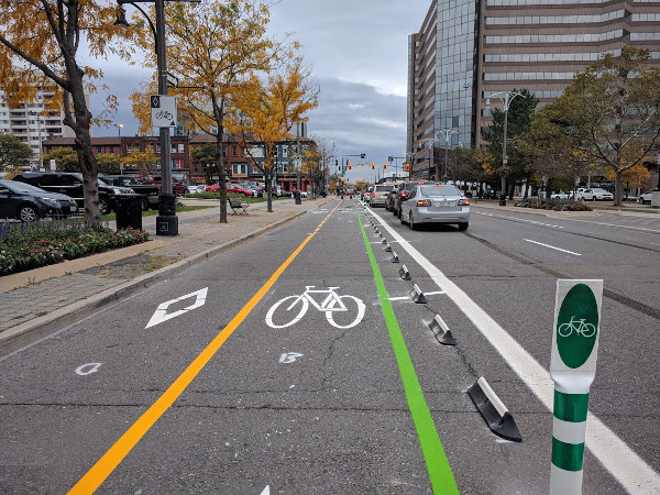
Physical protection for cycle track
Knockdown sticks are good for visibility but, as the name implies, they are designed to topple over if a car runs into them. The rubber curbing, on the other hand, is considerably more difficult for a car to jump.
Unlike the physical barriers on Cannon, which are installed along the bicycle-side of the buffer zone, the barriers on Bay are installed in the middle of the buffer. This gives cyclists a bit more space to avoid accidentally clipping a bollard.
The next major intersection is King, and this is tricky because a lot of drivers heading north on Bay turn left onto King. The City has responded to this by reserving left turns to a dedicated turn signal, which does not turn green until the latter part of the green cycle on Bay.
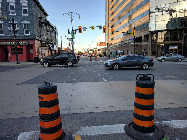
Bay and King
That means cyclists proceeding across the intersection on Bay have a grace period during which they don't have to contend with cars cutting across their path.
The new delayed left turn signal is already installed and in operation, allowing drivers to get used to it before the bike lanes go live.
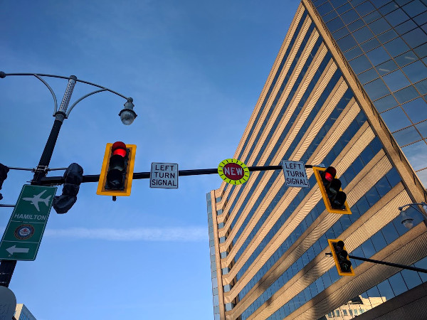
New left turn signal from Bay northbound onto King westbound
There wasn't much by way of pavement markings on York Boulevard when I arrived this past weekend, but I expect the City will install a bike box to allow cyclists to turn eastbound onto the York bike lane.
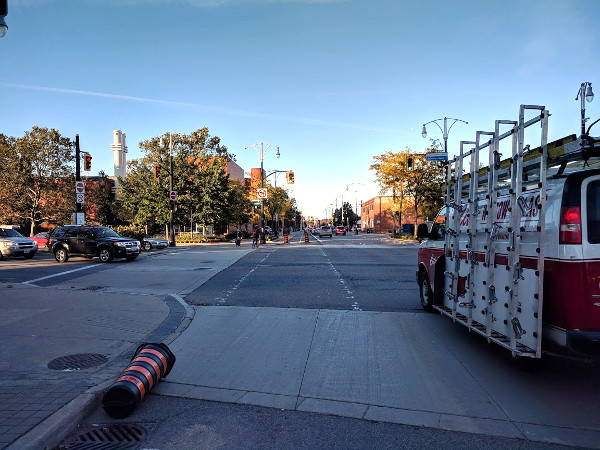
Bay and York
At Cannon, the Bay Street cycle track intersects the Cannon Street cycle track - a major accomplishment in the City's slow, gradual move toward a connected network of high-quality cycling infrastructure.
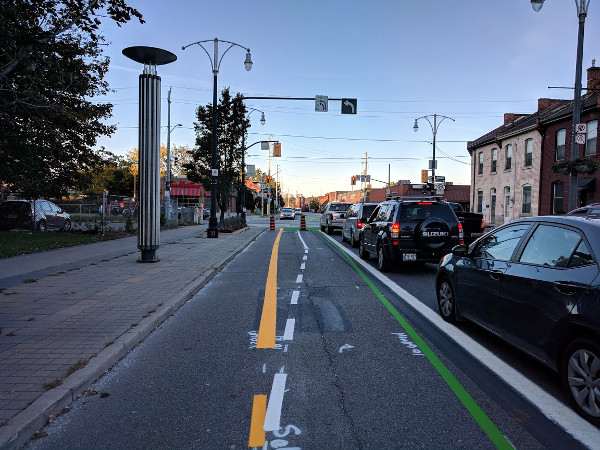
Bay and Cannon
The City has installed a green-painted bike box on Bay at Cannon to allow northbound cyclists to turn eastbound onto Cannon, and there is already an existing green-painted bike box for southbound bike traffic on Bay to turn east- or westbound onto Cannon.
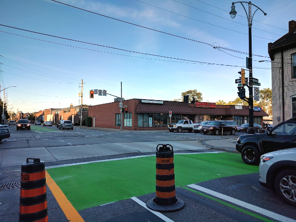
Bike box at Cannon
Cannon is also the end of the cycle track portion of the Bay Street bike lanes. North of Cannon, they revert to conventional painted lanes on the right (curb) side of the existing vehicle lanes.
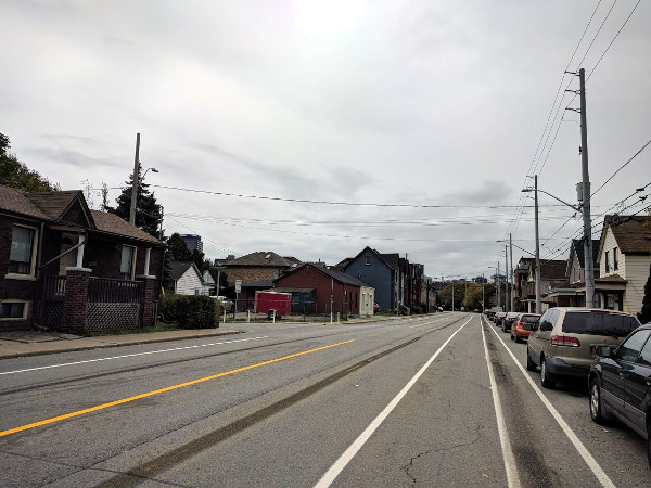
Bike lanes at Colbourne
While it's unfortunate that the City did not figure out how to extend a protected cycle track all the way to the West Harbour - with all the major destinations there, including the GO Station, Bayfront Park and Waterfront Trail - we must at least acknowledge that putting a "door zone" buffer between the southbound bike lane and the curbside parking is better than nothing.
It would have been better still to move the bike lane behind the parallel parked cars in order to use the cars as a physical barrier, as the City did on Herkimer and Charlton.
In another nice touch, the City resurfaced Bay Street between Colbourne and Stuart Street so cyclists have a nice smooth surface to ride upon. In other bike lane projects, the City has tended to paint the lanes along badly rutted and potholed street edges, making for a jarring and bumpy ride.
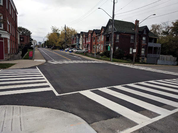
Bay and Stuart
The intersection of Bay and Stuart has been repainted with highly visible zebra crosswalks on all four sides.
While I was on Bay yesterday, I was saddened but unsurprised to note that automobiles are already using the unprotected bike lanes as a handy parking spot. One truck managed the feat of blocking both the new bike lane and the existing sidewalk in a double-barrelled middle-finger to active transportation.
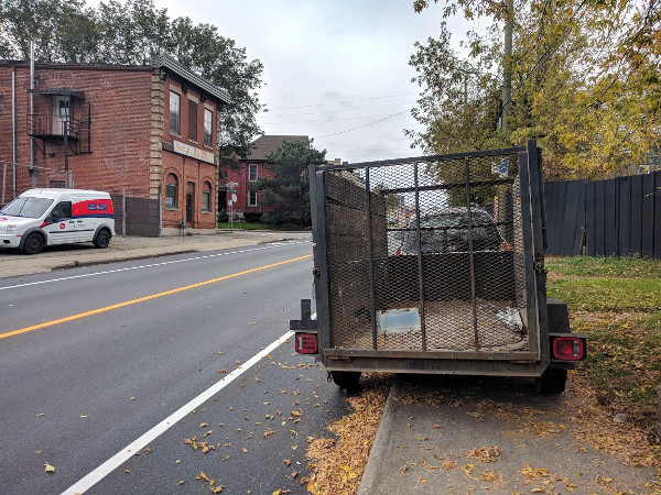
Bike lane and sidewalk blocked
North of Stuart, Bay Street already had vestigial bike lanes between Stuart and Strachan, which were installed when the bridge overpass on Bay across the CN train lines was rebuilt.
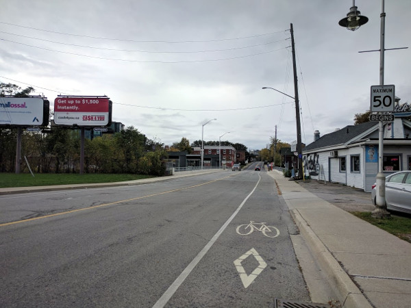
Bay and Strachan
Notwithstanding the issues with the Bay Street bike lanes - many of which the City can still decide to fix, like protecting the cycle track all the way to Aberdeen - it is pretty damned nice to see that early fragment of cycling infrastructure finally pay off with a continuous, two-way bike connection all the way between the Waterfront and Aberdeen.
By kdslote (registered) | Posted October 24, 2017 at 13:31:22
Such a game changer with 6 east west bike lanes being stitched together by these lanes!
York Blvd intersection update: As of yesterday afternoon there was a beautiful giant blob of green paint on York heading westbound with dashed lane markings across the intersection for southbound turns onto Bay. I suspect some changes to the light cycles will be happening as well to allow this manoeuvre to happen safely.
Comment edited by kdslote on 2017-10-24 13:39:25
By KevinLove (registered) | Posted October 24, 2017 at 21:13:13
My favorite part of this article:
...the City clearly recognizes that they need to physically protect the bike lanes (with large traffic cones) while the paint is drying to keep cars from driving across the paint, but fails to consistently apply the corollary point about keeping cars from driving over cyclists.
By JasonL (registered) | Posted October 26, 2017 at 08:39:59
one quibble from a driving perspective: I"m never a fan of designs that result in one driving along on a street and suddenly finding themselves in a left-turn only lane. The city did this on Cannon approaching Queen as well.
I've seen some close-calls already with drivers attempting to get over to the right b/w Main/King upon realizing that their through lane is becoming a turn lane.
And surely 1 left-turn lane would be suitable at King?
Small complaints tho...the lack of bollards south of Hunter is super annoying, but rest of this design looks like the best cycling project the city has built to date.
By kdslote (registered) | Posted October 26, 2017 at 12:29:02
The lanes were blocked by two large dump trucks between Herkimer and Charlton today. So frustrating! Thankfully I was heading northbound, so could go around reasonably well. It would have been more challenging for those headed southbound - requiring riders to dart into oncoming traffic to get around. Could be solved so easily with even basic physical separation!
By mdrejhon (registered) - website | Posted October 26, 2017 at 13:36:55
Another accomplishment that these lanes achieve, is that West Harbour GO station is now directly connected into Hamilton's cycle network.
Because of Metrolinx's board meeting this week, I was making some noise online and twitter (here, here) this week about stopping the seasonal Niagara GO train (covered in this RTH article)
That summertime GO train has a bike-dedicated coach, which is now directly connected to Hamilton's downtown cycle network --
But this train currently passes mere centimeters of West Harbour GO station without stopping.
Finally, construction is resuming to finally finish that second track through West Harbour GO station (CN Railways) -- will enough pre-requisites be completed by seasonal train start in May 2018?
It is also two-way and can bring visitors to Hamilton, while also allowing Hamiltonians to visit Toronto/Niagara more easily on bike too.
Imagine people doing a stopover in Hamilton (on way home) to stop in downtown Hamilton for dinner on James St N before continuing onwards to Toronto on the next GO train during the same evening headed in the same direction (there are 8 trains per summer weekend, 4 going Toronto-Hamilton-Niagara, and 4 going Niagara-Hamilton-Toronto -- but not stopping in Hamilton. Yet.)
Note: I also have additional brand new pictures of West Harbour GO station.
Comment edited by mdrejhon on 2017-10-26 13:43:20
By CharlesBall (registered) | Posted October 30, 2017 at 13:42:08 in reply to Comment 122050
I am well aware that these are not mathematical or even arithmetic calculations. When you show me that even 500 cyclists a day use that route v. 7,000 autos, I will eat my hat. The bike lanes have taken over 1/3 of the roadway. Right now that is tens of people v. 7000. Great for the tens, not so great for the thousands.
By CharlesBall (registered) | Posted October 31, 2017 at 11:07:28 in reply to Comment 122073
Ah. Emotional calculus. The same emotional calculus the NRA uses to promote gun use. "I am terrified of the threat" even though scientifically there is no threat yet "I need a gun." So we support "because cars are so fast and dangerous" even though there has never been an injury or death caused by a car on my street "I need a four way stop and a speed bump." Now our community will look good and "feel good" because we have bike lanes that hardly anyone uses and people can sit in traffic and blow smoke out their tailpipes going nowhere and wasting their time. My threatened identity is assuaged. Thank you.
By KevinLove (registered) | Posted November 01, 2017 at 11:47:11 in reply to Comment 122081
The actual information, taken from the City of Hamilton Vision Zero Website, is that:
1) Motor vehicle operators crush and kill an average of 16 people in Hamilton every year.
2) Motor vehicle operators crush and injure an average of 1,824 people every year.
3) Motor vehicle operators cause an average of $608 million in costs every year due to death, injury and property damage.
You must be logged in to comment.
There are no upcoming events right now.
Why not post one?