Now is the time to commit to a city-wide transportation network that is safe, equitable and inclusive, and makes it easy for everyone to choose healthier, cleaner, more sustainable and enjoyable ways to get around.
By Ryan McGreal
Published December 06, 2015
Every leader has a fundamental choice: to provoke and capitalize on people's selfish impulses, or to inspire empathy and caring for the well-being of others. At Friday's General Issues Committee meeting, Ward 8 Councillor Terry Whitehead chose the latter in bringing forward a motion to expedite a protected cycle track connecting the upper and lower city on the Claremont Access, and Council as a whole rallied to support his motion.
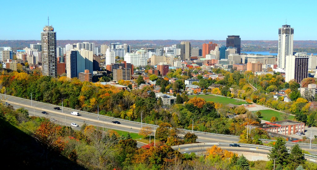
")
Claremont Access and extension from Southam Park (RTH file photo)
I am reminded of the old Vulcan proverb: Only Nixon could go to China.
It is terrible that we needed a tragedy to spur us into action on creating a safe cycling route up and down the Mountain, but thousands of years of human history drive home the point that humans are not very good at responding to abstract threats.
A cycling route on the Claremont Access has been in the City's plan for some time, but there was no appetite to get around to implementing it until a man riding a bike up the Claremont was killed last Wednesday after being struck by a person driving a dark-coloured truck.
The victim, 53-year-old Jay Keddy, was many things: husband to Ingrid, father of three adult children, popular Kindergarten teacher at Prince of Wales School, active church community member, well known in his Mountain neighbourhood, and many other things that those of us who didn't know him personally will never really know.
But the tragic circumstances of last Wednesday forced him into another role: as a powerful counter-example to the tired stereotype of who rides a bike in Hamilton.
As Hamilton Spectator editor Howard Elliot made clear in a moving editorial on Saturday, cycling is becoming steadily more popular right across Hamilton, but the City has fallen behind the curve.
Our Cycling Master Plan, already a modest network with a slow implementation schedule, has been further eroded by funding cuts, stripped staff resources and direct Councillor interference.
Bike lanes have already been vetoed or removed in wards 6 (east mountain) and 7 (central mountain), and Ward 5 Councillor Chad Collins just vetoed a planned bike lane on Greenhill Avenue because some local residents are opposed.
But like any network, a cycling network is only as safe, robust and usable as its weakest connection. The myriad routes that various people take on their individual bike trips (or would like to take, if they felt safe doing it) cross neighbourhood and ward boundaries indiscriminately; so when Councillors kill bike lanes in their wards, that affects people across the entire city.
So Council deserves our recognition and respect for moving quickly and decisively on a protected Claremont Access cycle track, but their sense of urgency about building our cycling network has to start there, not end there.
I would urge that the two-way cycle track extend South on the Claremont extension to West 5th, which is two lanes wide for most of its length and then narrows to one lane just before merging with West 5th. It can be one vehicle lane its entire length, leaving the second lane to connect the cycle track with the hospital and Mohawk College.
Total southbound traffic on West 5th at Brantdale is 11,000 cars a day, which combines the traffic merged from both Claremont extension and James Mountain Road, so we're talking about small traffic volumes on Claremont with no cross streets, driveways or private drives to consider.
There is plenty of room on the grassy median on the west side of West 5th to extend the cycle track all the way to Fennell.
Likewise, in the lower city the cycle track should extend north on Wellington all the way to Burlington Street to connect the waterfront via Ferguson Avenue.
")
Wellington Street North at rush hour (RTH file photo)
Between Wellington Street and Victoria Avenue, we're literally talking about 8-9 total vehicle lanes to carry roughly 20,000 cars a day. That's a tremendously easy opportunity to repurpose a surplus lane and connect the west mountain all the way to the waterfront!
I can't repeat this enough: a cycling network is only as safe, robust and usable as its weakest connection. Let's build the Claremont Cycle Track, but let's ensure that it connects on both ends to a network of safe, protected bike lanes that take people to the places they want to go without fear of serious injury and death.
Right now, the City is reviewing its Transportation Master Plan. This is a golden opportunity to commit to a city-wide transportation network that is safe, equitable and inclusive, and makes it easy for everyone to choose healthier, cleaner, more sustainable and enjoyable ways to get around.
Here is the text of the approved motion from Councillor Whitehead:
Delineated Bicycle Lane on the Claremont Access (Item 9.1)
WHEREAS, the City of Hamilton’s Cycling Master Plan is intended to guide the development and operation of its cycling infrastructure for the next twenty years;
THEREFORE BE IT RESOLVED:
That staff be directed to review the options and costs associated with providing a delineated bicycle lane up the Claremont Access and report back to the January 19, 2016 General Issues Committee.
By wooosh (anonymous) | Posted December 06, 2015 at 13:41:49 in reply to Comment 115424
Atta way to totally miss the point.
By JasonL (registered) | Posted December 06, 2015 at 14:37:32
Agree totally with the design opportunity staring at us here with this critical Central Mountain, central city, waterfront cycling route. One of the blessings of these vastly overbuilt roads in Hamilton is the potential for truly world-class cycling and pedestrian facilities without impacting car traffic in the slightest.
I hope the Claremont plan takes the cycle track right to Inverness Ave as proposed in Shifting Gears. Inverness leads to quiet residential streets which connect to Sam Lawrence Park. Also, a stop-light at Inverness would serve 3 purposes:
I would also suggest to the mayor and planning staff that we narrow the traffic lanes on the Claremont and post the speed limit to 50km. There's no reason for a freeway connecting two residential neighbourhoods in this manner.
Also, this path should be a wide, multi-use pathway from Main to Inverness/West 5th, not just a cycle track. What a fantastic new spot for exercising for those who enjoy walks, runs, cycling etc....
By narrowing the traffic lanes to more normal 10 foot widths, and by removing the unbound curb lane, we will probably gain somewhere around 15-20 feet for this new multi-use path. This is a massive opportunity for Hamilton. It's crucial that city hall listen to engaged stakeholders throughout the city, and through Cycle Hamilton when designing this route.
By Glend1967 (registered) | Posted December 06, 2015 at 14:37:53 in reply to Comment 115424
Bikes are legally allowed on the accesses.How pompous are you to suggest we can't use them.We pay taxes and have just as much right to them as you do.Slow down and pay attention!
By JasonL (registered) | Posted December 06, 2015 at 14:39:18 in reply to Comment 115424
"no cars" signage would actually save lives. 4 people have died on Hamilton roads this past week. Guess how many were killed by a cyclist?
By Glend1967 (registered) | Posted December 06, 2015 at 14:47:45 in reply to Comment 115428
@durander3263827..ding ding..How about that?
By JasonL (registered) | Posted December 06, 2015 at 15:33:57
One thing I forgot to mention: design.
I realize city hall won't want to spend much more than necessary, but considering the dramatic location and visibility of this new route, I would love to see it become an instant local landmark like the new Auckland cycle track:
https://twitter.com/BrentToderian/status...
What better symbol of a changing Hamilton than a sweeping pink pedestrian/cycle path from Inverness to Main St, visible from the Mountain Brow and the traditional skyline shot from Sam Lawrence Park
By ScreamingViking (registered) | Posted December 06, 2015 at 16:44:37
It would make a lot of sense to extend the Hunter bike lanes a couple of blocks eastward to connect with this.
And a connection between Claremont and the Rail Trail would be nice, either a stairway with bike trough, or a paved ramp depending on the steepness of that grade as Claremont starts to curve... looks like there's a footpath worn into the embankment so maybe a bike path is an option: https://goo.gl/maps/WiNahEL7vCA2
Comment edited by ScreamingViking on 2015-12-06 16:48:00
By Durander3263827 (anonymous) | Posted December 06, 2015 at 16:45:57 in reply to Comment 115431
Exactly. Not all streets are safe. Roads with no shoulders and that go at 70kph are not safe. Maybe one day the Claremont will have everything needed to be a good way for cyclists to ride up the escarpment, but as it is today, it's not.
By JasonL (registered) | Posted December 06, 2015 at 22:15:29 in reply to Comment 115439
and not all sidewalks are safe, and not all highways are safe (listing all the spots residents have been killed by drivers this WEEK alone).
Hmmm, seems to be a common trend regardless of the geographic location of the fatalities: car drivers.
By JasonL (registered) | Posted December 06, 2015 at 22:18:22 in reply to Comment 115438
totally agree. This Claremont/West 5th/Wellington idea has massive potential to be a game-changer. Possible rail trail and Hunter connections as you've pointed out (Hunter needs to get fixed ASAP between Catharine and MacNab). Also, connections to Cannon Cycle Track and future Burlington St connection to West Harbour. Also, the connection a couple blocks west to Ferguson Ave.
Even without a ramp to the rail trail (which should be included in this project), a cyclist could come to the bottom and take Hunter to Ferguson to Corktown Park.
By keithbeck (registered) | Posted December 06, 2015 at 23:56:45
One comment on your cycle track route continuing north from claremont access. just to avoid the bad driving of some in the area of Main and Wellington. Would it not be better for the Claremont cycle track to empty onto Hunter. Go north on Ferguson to Cannon. Then have a dedicated lane on Wellington from Cannon to Burlingo
By John Neary (registered) | Posted December 07, 2015 at 08:32:18 in reply to Comment 115453
Ferguson is a totally useless cycling route. I should know, because I live a block away from it and I am forced to use part of it every day because of the pointless one-way design of Mary.
Let me enumerate the reasons: 1. Stop signs, all-way stops, or traffic lights at every intersection from Charlton to Simcoe. Cyclists have to stop at every street 2. No protected crossing at Main. Not even a real curb cut on the north side. 3. No protected crossing at Hunter. 4. Tall, steep bridge with poor visibility over CN tracks 5. Sidewalk (not multiuse path) under CP tracks with poor visibility on either end 6. General lack of businesses or other important destinations along most of its course.
Cyclists overwhelmingly use Walnut and Mary over Ferguson.
By Stephen Barath (anonymous) | Posted December 07, 2015 at 08:36:40
Does "delineated" mean painted lines only? Anything is better than nothing, and maybe that would prevent injury to cyclists, which is obviously a good thing.
We should clearly state our goals and then figure out how to meet them. If our goal is to provide increased safety for the one percent of Hamilton commuters who are committed cyclists and bicycle to work in spite of the almost total lack of accommodation for them, I am in favour of that and definitely give them some space on the road to decrease their likelihood of injury or death. No question.
If, however, we want to give more people the option of cycling to a variety of destinations, painted lines aren't going to cut it. I personally am not going to ride my bike up the Claremont Access if all that separates me from vehicles going eighty or ninety kilometres per hour driven by the types of motorists we have in this city, is a painted line. I'm sure many other people would be in the same boat. If it's not protected, it's not going to be enough for most people. I'm still on board with it if it makes it safer for anyone, but it won't be safe enough. You're not really giving people more choice.
The other day, I was walking along Hunter and saw several groups of families using the bike lane there. One struck me because it was a (I presume) mother riding a SoBi bike with her two kids on their own bicycles. I never see this along Dundurn: on that street, if you go out for a nice bike ride with your family, or to work, there's a good chance you'll have to drive into live traffic because someone has left his vehicle blocking the bike lane. That's a non-starter for many, many people.
Again, this shouldn't be misconstrued as opposition to a bike lane on the Claremont Access. But no one should mislead themselves into believing it will create more bicycle commuters- if that is even our intent.
By mdrejhon (registered) - website | Posted December 07, 2015 at 13:49:04 in reply to Comment 115458
Does "delineated" mean painted lines only?
I have confirmed on Twitter that it's aimed as something better than a painted bike line.
@terrywhitehead on Twitter:
@craig_burley I have made it clear that the delineation must be a clear separation and not just a paint line.
.
@terrywhitehead on Twitter:
@QueSommesNous the request was for a delineated bike lane not just a paint line.
Comment edited by mdrejhon on 2015-12-07 13:49:22
By mdrejhon (registered) - website | Posted December 07, 2015 at 13:55:00
One possible vision for the Keddy Access (possible dedication to Jay Keddy) would be:
Also, if only one divider line is marked, then please use it to separate downhill bike riders. The uphill riders can mix with pedestrians, as uphill riders on Claremont are quite slow, often slower than a jogger. It's the downhill rockets that could also kill too, so be mindful to design the Keddy Access cycle track for that properly.
Comment edited by mdrejhon on 2015-12-07 14:00:49
By Stephen Barath (anonymous) | Posted December 07, 2015 at 15:36:06 in reply to Comment 115477
"the request was for a delineated bike lane not just a paint line."
I would say "delineate" does mean just a line, but I'm happy to hear he's using the word wrong and means an actual barrier.
By keithbeck (registered) | Posted December 07, 2015 at 15:56:02 in reply to Comment 115453
Thanks for the reply. Thinking about it a little more, making the intersection no right turn on red would deal with the concern I had about right turning traffic (from main to wellington).
By JasonL (registered) | Posted December 07, 2015 at 16:06:00 in reply to Comment 115487
I wrote here that I think 'no right on red' would be great to implement in all downtown's, BIA's, pedestrian oriented districts, school zones etc.....
By Pxtl (registered) - website | Posted December 07, 2015 at 17:47:51 in reply to Comment 115456
Yeah, I think Eisenberger missed his mark with pushing the Ferguson bikeway.
By Pxtl (registered) - website | Posted December 07, 2015 at 17:50:37 in reply to Comment 115453
To be fair, Wellington North does actually crawl at rush-hour. I'm not sure how that's even possible with 4 lanes of Wellington feeding into 3 lanes of Clairmont, but it does. I assume something to do with the light timings that obviously prioritize east-west traffic.
Getting a Cannon treatment on Wellington may be politically hard because of that inexplicable backup.
Using Hunter to Ferguson isn't my favorite plan, but it might be where we end up. Personally, I'd love both - use the Hunter/Clairmont ramp as a full T-intersection for cyclists.
By Pxtl (registered) - website | Posted December 07, 2015 at 20:38:29 in reply to Comment 115491
Wait, South. I meant Wellington South.
By Core-B (registered) | Posted December 07, 2015 at 21:34:48
Whatever configuration is agreed on, the grade is going to be an impediment for older riders (speaking from experience). I know this is probably pie in the sky, but I really like this idea: http://youtu.be/zipZ5kwhFfs
By ergopepsi (registered) | Posted December 07, 2015 at 21:36:17 in reply to Comment 115485
Kids in the Hall = 'delineate' - classic.
By Pxtl (registered) - website | Posted December 08, 2015 at 11:22:10 in reply to Comment 115489
To clarify, since this spilled over to Twitter: the redevelopment of Ferguson into a greenway happened under mayor Eisenberger during his previous term 8ish years ago. I don't know how much he drove the development personally, but I remember him being very proud of some of the work that was done there, particularly the bridge over the rail tracks. Ferguson is intended to be the main cycling corridor for the area.
I don't use it either - I take Victoria/Wellington to get to the HGH from Cannon.
By JasonL (registered) | Posted December 08, 2015 at 11:32:50 in reply to Comment 115531
I personally use Ferguson quite a bit, but agree whole-heartedly with some of it's glaring shortcoming:
However, I still enjoy it much more than Wellington or Victoria. No reason all of these issues can't be fixed ASAP, especially considering we never come close to spending our measly cycling budget at city hall each year.
By John Neary (registered) | Posted December 08, 2015 at 12:19:36 in reply to Comment 115532
It would be way easier, cheaper, and better to add contraflow signage on Mary from Barton to King William. Not that we couldn't do both ;)
By good news for cyclists (anonymous) | Posted December 08, 2015 at 16:51:06
Glad to see that the councillor many love to hate is getting in on this. Look forward to seeing that partitioned off lane become something usable and hopefully that will also get the city to fix the collapsed part of the escarpment too.
By JasonL (registered) | Posted December 08, 2015 at 18:18:54 in reply to Comment 115500
this should definitely be included IMO. It's quite cheap and would have a great impact for those not able to cycle up the escarpment.
By mdrejhon (registered) - website | Posted May 03, 2018 at 00:01:52 in reply to Comment 115478
As of May 2, 2018, I have started a petition that turns the "Keddy Access" naming (that I suggested in 2015) into reality. Allastair Keddy has confirmed that his family is behind this initiative.
Petition: Name the New Hamilton Multi-Use Trail in Honor of Teacher Jay Keddy
You must be logged in to comment.
There are no upcoming events right now.
Why not post one?