Understanding the suburban story can help bridge some of the gap between the seemingly disparate city visions of urbanites and suburbanites.
By Jeremy Parsons
Published April 22, 2016
This article has been updated.
Underneath the media's depiction of suburban serenity is a rich and stormy history.
- Elizabeth Ewen and Rosalyn Baxandall, Picture Windows
Today, most Canadians live in low-density suburban environments rather than compact urban or rural locales. In fact, according David Gordon (Professor at the School of Urban and Regional Planning, Queen's University) approximately two-thirds of all Canadians could be classified as suburbanites in some sense of the word.1
The last census data (2011) shows that despite progressive planning policy and a resurgence of downtowns across the country, most new residential builds continue to be single-family detached homes concentrated in peripheral neighbourhoods.2
In the U.S., the evidence also points to the fact that suburban areas are growing much faster than urban ones, despite a temporary inverse in the numbers in 2010-2011.3
Given this reality, it's perhaps surprising that few academics and urbanists seem to have a sustained interest in the distinctive stories of newer suburbs. During my research as a graduate student, I learned that Canadian case studies of suburban growth are relatively rare within the literature. The story of the origins of the Ancaster Meadowlands is a unique, local example of how land is urbanized and how greenfields can be transformed into polished suburban spaces.4
For many of the cheerleaders behind Hamilton's revival, suburban settings such as the Meadowlands do not seem to offer much in the way of interesting history, appealing architecture, or vibrant community. The neighbourhood exhibits many of the well-known characteristics of the prototypical postwar suburb-land uses that are largely divided, roadways that are fast and wide (both arterial and tract streets), a housing stock that is dominated by the single-family home, and large-scale corporate retail and stand-alone office structures located near highway connections.
Yet, despite many of the neighbourhood's commonplace traits, the Meadowlands possesses a surprisingly rich history. Long before the creation of modern amenities on the site, it was home to a series of Paleo-Indian tribes (some 9,000+ years ago).
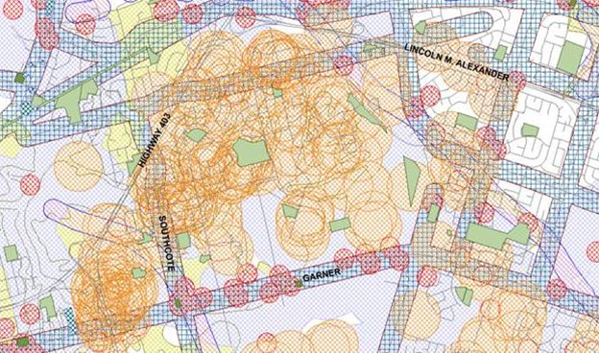
The City of Hamilton's Archaeological Management Plan (2012) showing the density of sites of early settlement material found within the Meadowlands.
Archaeological work carried out by between 1987 and 1997 uncovered over 34,000 unique artifacts and over 100 separate human settlement sites on the landscape. According to Archaeological Services Inc (ASI), the firm that carried out much of the work and the largest company of its kind in Ontario, the Meadowlands is home to some of the most culturally dense soils in the region.
We have always considered the Meadowlands as one of the richest properties we have investigated. Some of those sites yielded information that was not previously known. We considered [the area] to be of high heritage value and worthy of complete detailed investigation.5
It is remarkable that a place sometimes criticized by Hamiltonians as being placeless and culturally insignificant, was once a thriving hub of human activity. Most residents of the Meadowlands are also likely unaware that their homes are sitting atop some of the densest archaeological remains in the province.
During the pre-development study phase, the Meadowlands was also determined to be highly significant land from an environmental standpoint. A municipal class environmental assessment in 1990 found large populations of reptiles, amphibians, birds, and mammals inhabiting the area. A number of rare animals were present (and are likely still present) including the Jefferson salamander, the Eastern milk snake, and the cerulean warbler.
Geographically, the area is located on a low-lying plateau-a flat piece of land at a high point atop the Niagara Escarpment. It is also found at a confluence of streams and tributaries which run into Tiffany Creek and eventually connect with Ancaster Creek and Chedoke Creek. The location of headwaters on the site is part of the reason for the area's unique archaeological history; it was once a large wetland with a vast amount of plant matter used as a food source.
Another important aspect of the landscape's history was that it was one of the few pockets selected by United Empire Loyalists for settlement in pre-Canadian times. Neighbouring waterfalls beckoned as sources of power and rich agricultural soils allowed for the cultivation of crops untenable in regions farther north. Its central location was a critical connection point between southern Ontario, eastern Ontario, the Niagara peninsula, and Lake Ontario.
Perhaps surprisingly, within the Meadowlands there are still some historical landmarks that remain from this period of European settlement. Built in 1816, "Harmony Hall" was the Gothic Revivalist home of a War of 1812 veteran and his family located just off Southcote Road. The Joseph House homestead (1875) is located at the intersection of Golflinks Road and Highway 403, standing in contrast to its modern suburban surroundings.
Other historically significant buildings that remain in the neighbourhood include 1021 Garner Road East (1854), 243 Garner Road East (1858), 1051 Old Mohawk Road (1871), and 232 Golf Links Road (1929). Although limited in number, these structures share meaning and point locals to the historical narrative of the area.
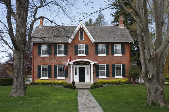
Harmony Hall: the legacy of local settler Israel Dawdy (1769-1851). The home was designated as a heritage property in 2002. Far removed from its initial agricultural context, the building is now located in a survey named after the property itself (Source: Panoramio).
Of course, it likely goes without saying that agriculture was the predominant land-use in the pre-development history of the Meadowlands. Aerial photographs during the interwar and early postwar periods show a checkerboard of forests, farms, and orchards covering much of the landscape.
It wasn't until the 1950s that Ancaster experienced any sort inclination towards suburban expansion. Small but new surveys began to spring up along Mohawk Road, Highway 53, and Fiddler's Green in order to accommodate returning baby-boomers. In the 1960s, Highway 403 was built to cut across the town and connect the region's transportation infrastructure to points east and west.
The road's location acted as a significant impetus for developers to choose the Meadowlands as a site for large-scale suburban growth. The progression of growth ever since has created an incessant struggle for Ancaster-juggling two competing identities: the country and the city, agriculturalism and suburbanity.
The first acquisition of large parcels of land within the future Meadowlands came through the efforts of the provincial government by means of its development arm, the Ontario Realty Corporation (ORC). This purchase was a part of a wider trend of speculation by the ORC with the goal of profiting from appreciating land value in peri-urban locations during the 1960s and 1970s.
In 1962, 1200 acres of undeveloped farmland between Garner Road and the 403 were sold to a development syndicate under the leadership of Sam Sniderman, a well-known investor from Toronto.
As is common practice in greenfield locations, area farmers who had originally sold the land to purchasers would continue to farm the land as renters until the fields were either developed or re-sold. In the case of the Meadowlands, the period between the initial land acquisitions from farming landowners to the eventual paving of the landscape was an astounding 22 years.
In 1968 the Sniderman syndicate located buyers for the land in a coalition of GTA developers.6 Later that year, the new owners put together a $250 million, 400-acre development plan on the site called "Mohawk Trail Village". By 1969 it was clear that this plan would never be realized as one of the development firms, Revenue Properties Ltd., encountered financial troubles and convinced the coalition to sell the property.
In July of that year it was sold to an Alberta-based development colossus known as Allarco Developments.7 Allarco held the land for about 12 years, acquiring additional sections of land over that time, and produced a series of grandiose designs to urbanize the fields.
With the conspicuous backing of a set of zealous Ancaster politicians, Allarco proposed to effectively create a brand new town: 25,000 new residential units and large-scale retail on a quiet agricultural landscape. En masse, Ancastrians demonstrated and petitioned to oppose the plans. The 1970s were a decade of bitter fighting over the fate of the town, with residents and activists on one hand and an alliance of developers and politicians on the other.
A large part of the land-use discord revolved around the fact that the developers were guaranteeing to finance new sewer and water servicing for the town in exchange for green-lighting the mega-development. This carrot came at a time when, like many other small towns in Canada, Ancaster operated on a rudimentary system of private wells, septic tanks, and weeping beds.
In the spring of 1972, hundreds of protesters gathered at the Ancaster Old Town Hall, spilling outside of the building onto the lawn and the street. Some residents quipped that the infrastructure and residential development was being built "to let this community develop into another Scarborough or Etobicoke."8
Although the residents were keenly suspicious, the town's politicians, surprisingly, maintained support for the plan and attempted to have the servicing pre-approved in order to facilitate Allarco's development plans. This case study raises the strong possibility of a mutually beneficial political alliance in Ancaster's development history given the close, and sometimes undemocratic, relations between land owners, developers, and politicians.
In 1973, after Ancaster was incorporated as a town in the new Regional Municipality of Hamilton-Wentworth, its planners created a comprehensive Official Plan that consolidated Allarco's development strategy into an official document, anticipating an additional 55,000 new residents to the area over 25 years. Many residents, who were still at odds with the local government, called the plan "a sell-out to Hamilton," and "a blueprint for rape by developers."9
In objection to the plan and Allarco's development goals, NIMBY locals organized and confronted the mega-development at the Ontario Municipal Board (OMB). Not surprisingly, the weight of Allarco's lawyers and the supportive testimony from Town of Ancaster officials assured a victory over Ancaster's residents' associations effectively giving sewer and housing construction a green light.
Not long after these controversial decisions, Ancaster hosted its first election as a newly incorporated town.10 In the face of public fury, the council underwent a significant turnover. Only two out of seven incumbents were re-elected post-1973.11
Despite having the majority of necessary legislative approvals in place, Allarco's high-density plans were not looked upon as favourably by the new set of councillors in Ancaster. In 1980 the case once again wound up at the OMB with the board ruling in favour of Allarco. The appellant parties-under the leadership of then mayor Ann Sloat-followed the chain of jurisdictional appeal all the way to the Executive Council of Ontario.
According to former Ancaster planner Peter Tollefsen, "Ancaster's solicitor recommended that we appeal the OMB decision to provincial cabinet. The mayor filled a bus of locals to demonstrate in Queens Park."12
On July 8, 1981 - in what may have been one of the last land-use decisions ever made by the Ontario Cabinet - Ancaster was defeated and Allarco was permitted to proceed with their large-scale development plans.
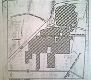
Map: Allarco's land holdings in Ancaster in 1980. (Image Credit: Hamilton Spectator map, L. Cooper, 1980)
Although Allarco won a series of major land-use battles in Ancaster, their fortunes quickly began to change in the 1980s. A slumping housing market and costly legal fees started to weather the Western developer. In 1981, after years of public discord and legal conflict, Allarco sold its land assets in Ancaster to Calgary-based Carma Developers Limited for an estimated $15 million.
In view of the now infamous 1980's economic recession, Carma's fate seemed to follow that of the land owners before it. In 1983 Carma went bankrupt and was forced to give up the still undeveloped Meadowlands to lenders from the Bank of Nova Scotia.
Later that year, a new buyer was located in a local developer named Alec Kelly. Kelly formed a twelve-man financier team around him (which included Ron Joyce) in order to acquire the land for development.
Under the name "Cloverleaf Village," the newly-formed company purchased a 1,200 acre parcel for only $5 million. As long-time Ancaster political figure Lloyd Ferguson put it, "this deal was a total fire-sale for Kelly and his partners."13
The first shovels hit the ground in 1984 with the construction of the Scenic Woods subdivision, just north of the Meadowlands Power Centre. Interestingly, the Cloverleaf partners were treated much more favourably by residents and local politicians than prior developers. Their local status, their conciliatory consultation approach, their flexibility in terms of density, and a desperate economy all contributed to an abatement of NIMBYism in Ancaster.
The original plans put forward by the group were for a hybrid residential-commercial community on the site with the same name as the group: "Cloverleaf Village". In 1988 Cloverleaf merged with another local developer Alterra Developments Limited. Alterra purchased half of Cloverleaf's shares and the new, numbered company was known publicly as "The Meadowlands of Ancaster," from which the community gets its name.
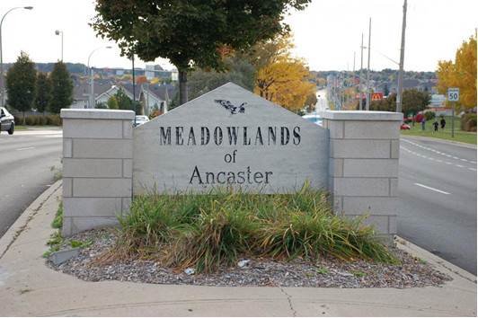
'Meadowlands of Ancaster' ca. 2011. This photograph looks west across Golf Links Road (Image Credit: Shawn Palmer ReMax Escarpment Realty).
According to Kelly, the name itself was taken from the well-known Meadowlands Racetrack in East Rutherford, New Jersey:
When my wife and I went down to Florida, we passed a stadium called 'the Meadow-lands' [in New Jersey]. I said to her, "How about the Meadowlands? The Meadowlands of Ancaster?" ... We wanted it to have Ancaster in the name because that had sort of a prestigious feel to it, you know. We thought it sounded much better than the "Meadowlands of Hamilton."14
In 1989 the company proceeded with plans to build an enormous new community that would feature more than 3,000 housing units as well as a shopping centre and business park. After a cascading narrative of sales, defaults, and land swaps, the Meadowlands would finally be built.
According to company general manager Alido DiIorio, in a generous mix of metaphors, "The new Meadowlands of Ancaster will be the plum and crown jewel of real estate development in the region. We want it to be the flagship community of the area."15
Kate Barlow of the Spectator reported that "the first 211 luxury detached houses have been pre-sold for between $269,900 and $360,000,"16 impressive numbers for the time period.
By 1994 construction on the western leg of the Lincoln Alexander Parkway was nearing completion and work on the Power Centre began. Subsequently, the residential surveys south of Golf Links Road were all completed in phases over the next decade (Phase I-V).
The landscape's former character as a wetland has added a number of infrastructural complications to the traditional suburban building pattern. Within the Meadowlands, each small park and natural area has been specifically engineered for stormwater management.
By 2012, the Meadowlands was largely completed and Ancaster had reached a population of 37,000. Most development that has occurred since 2012 within the area has been infill, beautification, or infrastructural improvements.
Today, the Meadowlands largely consists of detached, single-family homes, despite a few apartments along Golflinks Road and some townhomes constructed in the later stages of development.
Interestingly, there are numerous cases, throughout Ancaster's history of the NIMBY ethos appearing in the form of the opposition to low-income housing, apartment buildings, and development higher than three-stories tall. In essence, historically-speaking, Ancastrians rarely found palatable any housing types that deviated from the single-family norm.
Although the Meadowlands is now complete, the process of urbanization continues on Hamilton's periphery. In Ancaster, the city's former southern urban boundary (Garner Road) has been expanded and re-drawn due to the plans for the large-scale growth of the Airport Employment Growth District (AEGD), greenfields intended for airport-driven economic development.
Given that few buyers have been located for the employment lands and local builders have lobbied city hall for years to allow new housing within the AEGD, the land-use reality of this growth district remains to be seen.
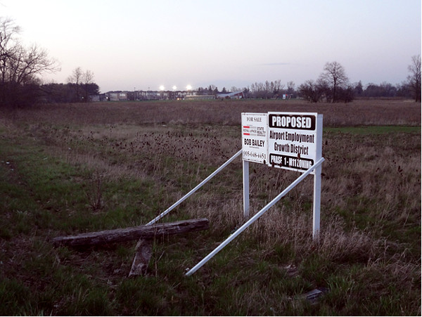
Looking northeast from agricultural fields now rezoned for the paving as the AEGD employment lands (Image Credit: Jeremy Parsons)
The development of the Meadowlands has substantially altered Ancaster's physical and social landscape. Although most residents appear to be pleased to live in the area-aside from the traffic on Golf Links Road-others have criticized it for being highly automobile-oriented, sprawling, and lacking community. One thing it cannot be criticized for is lacking a robust and intriguing historical narrative, despite there being very little knowledge of the neighbourhood's past.
The large number of retention ponds and storm water infrastructure, for example, points to the community's surprising past as a wetland and crucial feeding-settlement site for early Indigenous peoples.
The housing and commercial development itself also sits atop land that was wrestled over for years-recurrently changing hands and continually sparking citizen outrage. Land-use decisions within this space have frequently required third-party planning/legal bodies to mediate conflict.
The land has also hosted an unusual number of development companies who either went bankrupt or nearly so. Within a twenty-six year period, four of the seven companies who owned land in the Meadowlands during that time ended up financially ruined.
Given that the suburbs are the location of choice for many new immigrants and first-time homebuyers, it makes sense to better attend to their histories. Understanding the suburban story can help bridge some of the gap between the seemingly disparate city visions of urbanites and suburbanites.
It can also help those in the suburbs better appreciate and connect with their neighbourhoods, leading to less automobile-oriented disassociation.17 Finally, once a history is shared it can then be celebrated, lamented, memorialized, and used to add life and vision to communities.
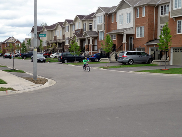
A row of townhouses in one of the newer surveys in the Meadowlands, adding density, income variation, and (here) a little street life to the neighbourhood
1. David Gordon and Isaac Shirokoff, "Suburban Nation? Population Growth in Canadian Suburbs, 2006-2011," Council for Canadian Urbanism Working Paper #1, July 2014.
2. Even Millennials, who were once hailed as the harbingers of urban renewal are now being shown to value home ownership just as much as suburban-driven Boomers. See: The Canadian Press, "Millennials value home ownership as much as most Canadians, CIBC Poll Says," CBC News, http://www.cbc.ca/news/canada/toronto/millennials-home-ownership-canada-1.3507247, March 25, 2016; Deeksha Sharma, "Low housing inventory causes Hamilton prices to rise," CBC Hamilton, http://www.cbc.ca/news/canada/hamilton/news/low-housing-inventory-causes-hamilton-prices-to-rise-so-far-in-2016-1.3524919, April 7, 2016.
3. Laura Kusisto, "More Americans Are Again Moving to Suburbs Than Cities," The Wall Street Journal, http://blogs.wsj.com/economics/2016/03/24/more-americans-are-again-moving-to-suburbs-than-cities/?mod=djemRealEstate_h, March 24, 2016.
4. For the sake of grammarians, I prefer to refer to the "Meadowlands" as a singular noun not as a multitude of lands.
5. Taken from an interview conducted with Dr. Ron Williamson (Chief Archaeologist & Managing Partner at ASI) on April 27, 2015.
6. This coalition included a 50% share split between Revenue Properties Limited and Crangmore Developments (25%) and Green Downs Limited (25%).
7. Interestingly enough, Hamilton's connection to Allarco was thanks in part to the legacy of football in the city. Former CFL player and Hamilton Real-Estate Board President Vincent (Jimmy) Quondamatteo made contact with Allarco's founder and Edmonton Eskimos team owner Charles Allard while playing for the Eskimos between 1950 and 1955.
8. "The public protests: Ancaster residents rally to fight plan for sewer complex," The Hamilton Spectator, June 6, 1972.
9. "Plan called blueprint for rape," The Hamilton Spectator, March 6, 1973.
10. Prior to this it was known as a village within a township of the same name.
11. "Ancaster Councils 1964-2015," Ancaster Municipal Building portraits, accessed June 18, 2015.
12. Taken from an interview conducted with Peter Tollefsen on August 2, 2015.
13. Taken from an interview conducted with Lloyd Ferguson on June 18, 2015.
14. Taken from an interview conducted with Alec Kelly on June 23, 2015.
15. "$1B development will mean a dramatic change in Ancaster," The Hamilton Spectator, Feb. 11, 1988.
16. "Ancaster prepares for the boom," The Hamilton Spectator, April 9, 1990.
17. Being less "in place" and being less attentive to the place.
Update: A non-final draft of this article was published, and RTH regrets the error.
By KevinLove (registered) | Posted April 22, 2016 at 11:43:27
If suburban homeowners had to pay the true costs of their lifestyle choice, there would be a lot less of them.
But as long as they get to reach into the pockets of everyone else to finance their lifestyle, I predict that little will change.
If certain Councillors who rant about "Communism" really believed in a free market, they would promptly derail the suburban gravy train.
By A Smith (anonymous) | Posted April 23, 2016 at 14:56:26 in reply to Comment 117851
Here is a comparison of some actual city budgets.....
City of Oakville (city and regional portion) expenditures in 2014 were approximately $442M ($373M not including social welfare/housing) / 182K citizens = $2,428/$2,049 per person.
City of Burlington (city and regional portion) expenditures in 2014 were approximately $472M ($402M not including social welfare/housing) / 182K citizens = $2,622/$2,233 per person.
City of Toronto expenditures in 2014 were $10.944B ($8.15B not including social welfare/housing) / 2.79M people = $3,940/$2,921 per person.
City of Hamilton expenditures in 2014 was $1.544B (1.145B not including welfare) / 546k people = $2,828/$2,097 per person.
If we look at transportation costs, we see that Toronto spends $1,023/person. In Oakville, Burlington and Hamilton it's $360, $422 and $592 respectively.
If we plug in Burlington's per capita transportation budget for Toronto, we see that it's city costs fall back in line with Oak/Burl/Ham. It would appear that all that public transportation costs taxpayers lots of money...an extra $600 dollars/year. Moreover, where are all the higher costs associated with sprawl cities? They don't appear anywhere in the city budgets.
I guess you could argue that they are the costs of owning a car, versus relying on public transportation, but that is a personal choice. On the strict tax costs associated with running a city, it would appear that sprawl beats density.
By AnjoMan (registered) | Posted April 26, 2016 at 07:49:39 in reply to Comment 117868
Where did you get the idea that Toronto is not a sprawl city? Yes, we have a subway and some nice bike lanes but most of the city beyond the core is sprawl and auto-oriented development.
By John s (anonymous) | Posted April 22, 2016 at 22:39:17
Good stuff! Thanks for sharing Jeremy!
By David Gordon (anonymous) | Posted April 28, 2016 at 15:58:10
Thanks for citing our research on Canadian suburbs.
More research at
CanadianSuburbs.ca
including Hamilton data.
More case studies of Canadian garden suburbs at:
canadianurbanism.ca/canu-case-studies
Including Hamilton's Westdale.
Regards
David Gordon
Professor and Director
School of Urban and Regional Planning
Department of Geography and Planning
Queen’s University
You must be logged in to comment.
There are no upcoming events right now.
Why not post one?